
The Addicks and Barker dams are part of the federal flood control project. They are intended to retain water during heavy rains in order to decrease the severity of flooding downstream along the Buffalo Bayou River in Houston. Read more about the history and operation of these artificial reservoirs at houstoname.
The history of Addicks and Barker
In 1929 and 1935, floods occurred in Houston, devastating the city center. They prompted Congress to allocate federal funds to the US Army Corps of Engineers to build a flood control plan for the Houston area. This 1940 plan authorized the construction of the Addicks, Barker and White Oak Creek reservoirs.
The Addicks and Barker dams were built from 1942 to 1948. The city spent around $4 million on their construction. In the 1980s, the two dams were renovated in accordance with the revised federal dam safety standards.
Initially, the dams and reservoirs were positioned far from the developed areas of Houston, but in the late twentieth century, the city erected thousands of single-family homes around them.
Addicks
How do the dams operate?
Addicks and Barker were designed to connect Houston’s watersheds and bays, which run through the region like leaf veins and lead to Galveston Bay and the Gulf of Mexico. Reservoirs collect and store excess rainwater that drains from the ground above, thereby serving as a flood control reservoir. The stored water is then discharged through outlet pipes or pipelines positioned at the bottom of each dam.
The reservoirs are intended to keep water out during heavy rains, reducing the flow of water to Buffalo Bayou and the risk of floods. It protects Houston’s economically significant areas, including the city center, Memorial, River Oaks, Montrose, Fourth Ward, East End and Washington Avenue.
Barker
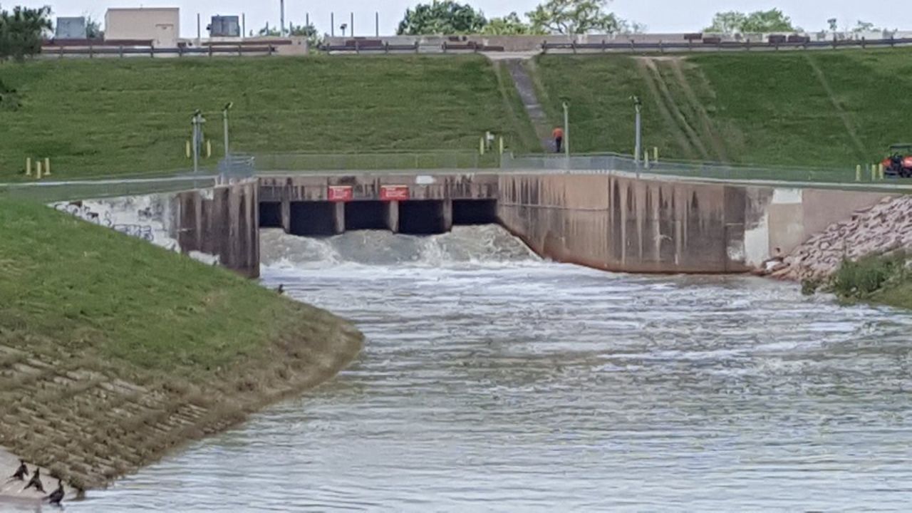
Where the Buffalo Bayou River begins, both dams feature controlled exit gates that enable outflow at an optimal rate. Flood protection tanks store floodwater and gradually release it through closed outlet pipes. The gates at the ends of the pipes can be gradually opened to control the quantity of water discharged from these dams, reducing flooding downstream.
The far ends of both dams feature emergency spillways. They are required to guarantee that water flows out of reservoirs during extreme conditions, hence averting a dam breakdown. So, when reservoirs begin to fill, some of the water contained by the dams can be released via the spillways.
No ordinary dams
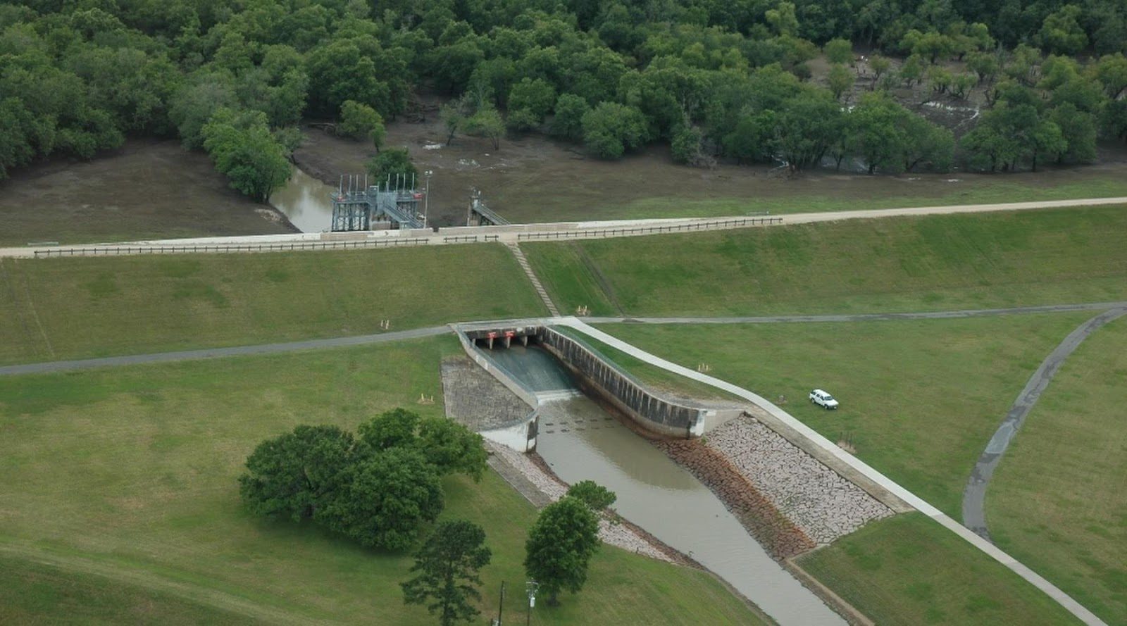
The dams constructed to form the Addicks and Barker reservoirs differ from ordinary ones. In comparison to others, they are quite practical and made of compacted layers of soil in the reversed “C” shape.
These structures were erected on terrain that slopes gradually to the northwest. At the same time, the tops of the dams are horizontal and at identical heights (save for the ends). The ends are narrowed to the ground and covered with a protective layer of concrete, allowing the narrowed parts to function as emergency spillways.
Each cone is placed at a different height, allowing to track how the flow rate gradually increases (since all the water flows into the same bay), and does not flow out on both sides at the same time. Addicks Dam is approximately 36 meters above sea level at its highest point, whereas Barker Dam is around 35 meters.
Record levels of flooding
In August–September 2017, Southeast Texas saw devastating floods due to Hurricane Harvey. Harvey began as a prolonged tropical storm and eventually became a Category Four hurricane before hitting the Gulf Coast in the United States.
Harvey made its first landfall on the US coast on August 25 near the Texas city of Rockport, before returning to the Gulf of Mexico and making another strike on the US coast near Copano Bay, slowly heading towards Houston. The hurricane then returned to the Persian Gulf before making landfall in the United States west of Cameron, Louisiana, for the third time on August 30.
During Harvey, unprecedented rainfall raised the water level in the Addicks Reservoir to more than 33 meters above sea level and more than 30 meters in Barker. Although the reservoirs were not completely resistant to flooding, they did greatly lower the catastrophic consequences for the city.
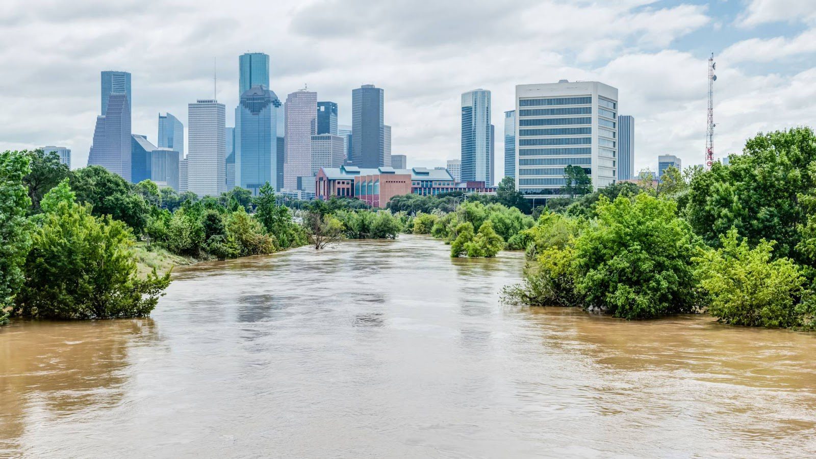
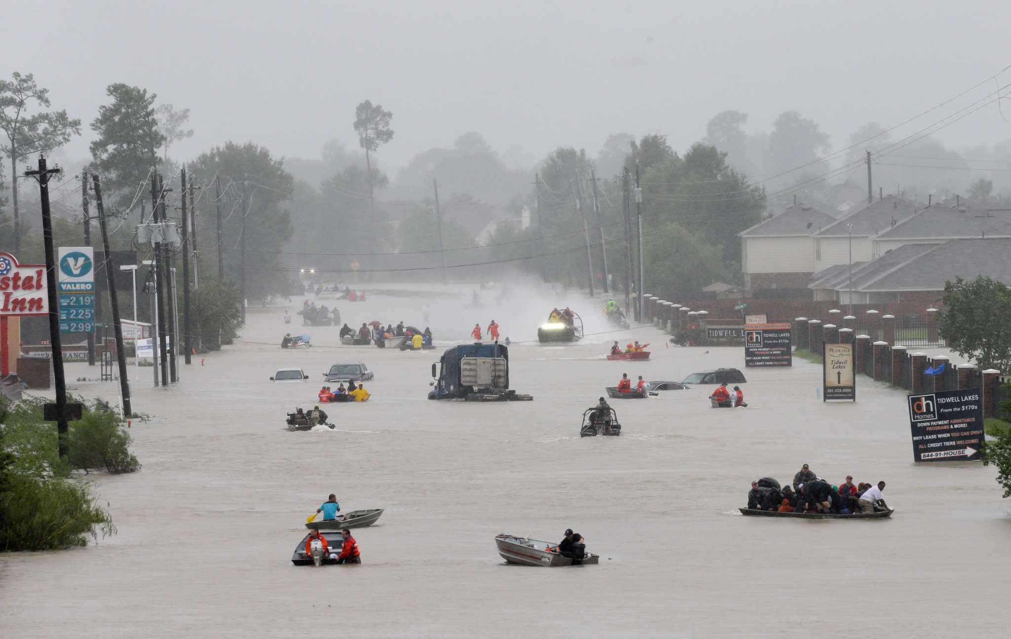
To reduce flooding upstream, the US Army Corps of Engineers released water at a controlled rate through the exit gate during and after Harvey. The total amount of water released via both dams’ gates surpassed 4,572 m3 per second, much beyond the capacity of the Buffalo Bayou current. These involuntary actions caused flooding of downstream areas. Then, more than 10,000 residences near these two bodies of water were affected by flooding.
Harvey wasn’t like a typical storm. The amount of rain that fell could have filled the Astrodome sports stadium 3,200 times. The severe rain necessitated substantial regulated releases of water from reservoirs during the next two weeks. Following the completion of these large-scale controlled discharges, regular discharges continued for almost three months until the tanks were emptied.
When Buffalo Bayou overflowed, the water sought other places to go. This created significant difficulties for homeowners who lived near reservoirs. City officials removed thousands of residents from their houses in the endangered area. By uniting around a shared tragedy, the city preserved its unbreakable character. Teams of inflatable boats and human chains were able to rescue those caught in stormy waters.
In total, the hurricane claimed the lives of at least 107 people, one in Guyana and 106 in the US. In Texas, around 336,000 people were left without electricity, and 103 people died as a result of the storm, 68 from direct and 35 from indirect causes. The disaster resulted in a fuel shortage that affected more than 20% of oil refining capacity. Panicked drivers created huge queues. Due to the panic, many gas stations were closed.
Around 30,000 Texans were forced to abandon their homes. More than 1,000 structures were entirely destroyed, and over 17,000 were severely damaged. In addition, the natural disaster damaged about 700 industrial enterprises.
Recreation near the reservoirs
There are numerous parks on the Addicks Reservoir, including Bear Creek Pioneers Park, which has hiking, cycling and horse trails. It is a wooded park with numerous recreational facilities, including a golf course, tennis courts, soccer fields, rugby fields and picnic areas. Bear Creek Pioneers also comprises the Houston Farmers and Ranch Club Center, Texas A&M AgriLife Center and a community center. The park also features drinking fountains. There is also an asphalt bike path on Addicks that begins near Sherwood Elementary School.
George W. Bush Park is located on the territory of the Barker Reservoir. Here, you can also find a shooting range, football and baseball fields, horseback riding trails and a dog park.